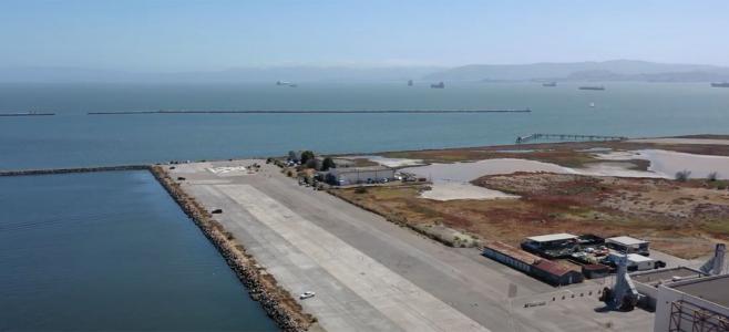
Recent research conducted at the Menlo Park office of the U.S. Geological Survey indicates the proposed Saltworks Project site in Redwood City is currently subject to a significant amount of flood risk - which will increase dramatically as sea levels rise further.
This map was created by Noah Knowles at USGS and shows a color-coded representation of areas vulnerable to inundation by average 100-year high-water levels for given amounts of sea level rise. I merely added an additional layer to the map depicting the location of the proposed Saltworks Project, as shown in orange. Dr. Knowles' original maps and supporting peer-reviewed paper, published in 2010, can be found here. If you're having trouble viewing this map this file can be opened directly in Google Earth.
Areas subject to inundation under corresponding increases in sea level rise (SLR)
- no SLR
- 50cm SLR
- 100cm SLR
- 150cm SLR
- Proposed Saltworks Project
- note: 50 cm ~ 20 inches
It is important to note that areas designated as wetlands in the NLCD01 dataset are excluded from this map. This includes a majority of the tidal wetlands and salt ponds in the South Bay, including a majority of the proposed Saltworks Project site. Had these been included they would likely be shaded in blue, which include areas that are inundated or vulnerable to inundation under existing conditions.
Areas of potential inundation include land protected by levees and areas that flood at least once every 100 years, on average. Areas currently behind levees would be inundated only if those levees fail. Regions shaded turquoise, yellow and red represent vulnerable areas in the event of increases corresponding to 50, 100 and 150 centimeters (cm), respectively. Dr. Knowles' research did not include forecasts of when the various amounts of sea level rise will occur but notes that projections from other studies indicate a minimum of 50 cm of sea level rise to a maximum of 200 cm is likely to occur by 2100.
Under current proposals for the Saltworks Project, developers plan on filling large portions of the salt ponds and creating sizable levees to protect homes planned for the site. This not only represents a huge loss of relatively easy to restore habitat and a level of Bay infill not seen since the early 1960s but would increase flood risk in other parts of the Bay. Filling of this site would result in the loss of former tidal wetland habitat suitable for storage of flood waters during storm surges or the gradual advance of rising sea levels. This ability to buffer flood risk is referred to as as flood storage capacity and is an additional ecological service provided by this site and other undeveloped sites along the Bay. During tidal storm surges or tsunamis water must go somewhere and without areas capable of withstanding periodic inundation this water will be forced towards other areas, such as nearby East Palo Alto, which is already subject to periodic flooding.
This USGS map likely represents the most scientifically defensible projection of sea level rise in the Bay Area, based on 100-year projections of hourly water levels using a model that has been proven to be applicable for hydrodynamic modeling of the San Francisco Estuary. This research was funded by the California Energy Commission's Public Interest Energy Research (PEIR) Program through the California Climate Change Center at Scripps Institute of Oceanography and by the CALFED Science Program CASCaDE Project.


